
Good morning! A very different start to the day today, as we’re looking at more moisture, more clouds, and a bit of dense fog too.
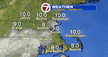
We’ve seen some areas with visibility below a mile (the ideal scenario is 10+miles, for perspective). Be careful behind the wheel! Low beams, low speeds in the spots where visibility is low.
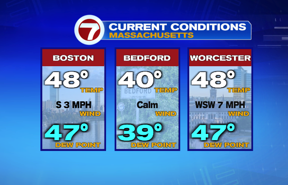
All that said, the day starts out dry. We DO have to track a storm for later today, but I certainly don’t want to ignore the fact that a good part of our Sunday remains dry for those who want to spend time outside!
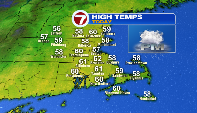
We’ll see temperatures climbing up from the 30s and 40s into the upper 50s and low 60s again today– a similar feel to yesterday afternoon in terms of the numbers. If you’re hoping to go explore Snowport, the SOWA Christmas Market, or check out the new Faneuil Hall Christmas tree, you’ll have time do to all of that (or anything else) without getting wet!
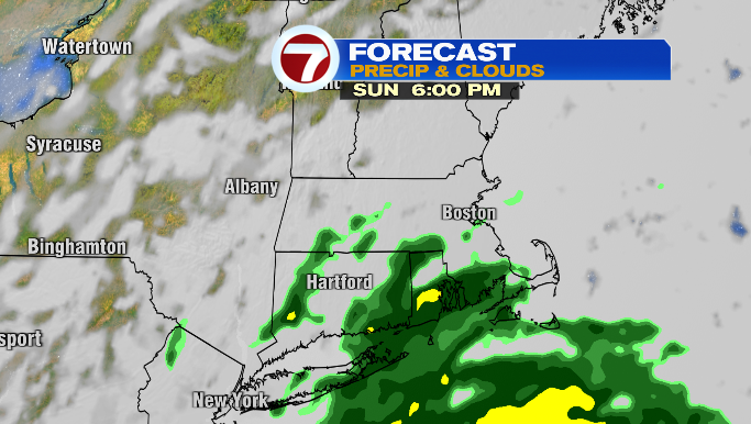
As for the raindrops? They arrive close to sunset, with this storm generally moving south to north. The farther north you live, the later you’ll see rain. Areas in central and western MA will also see rain a little later than southeastern Massachusetts will.
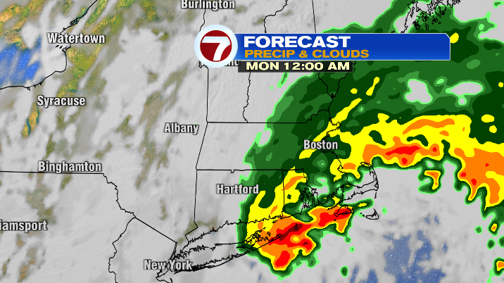
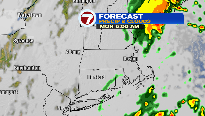
As we head through the evening into Sunday night, rain becomes more widespread and heavier as well. The good news about this storm is it’s a relatively quick-mover. While it’ll keep raining overnight into early Monday morning, the bulk of the storm will be gone in time for the Monday morning commute.
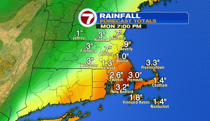
Between now and then, the heaviest rain will be for the South Coast/South Shore and parts of the Cape. Those spots could see 1-3″ of rain by Monday morning. Areas northwest of I-95 will generally be between 0.25-1.0″.
We could still see some mist/drizzle and a lingering shower, especially for southeastern Massachusetts, into early Monday afternoon, but the trend is the rain AND the clouds easing up throughout the day. In fact, Monday afternoon we’ll start to see some sun, and temperatures will be warm once again in the low to mid 60s!
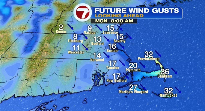
It’ll be a windier day, with gusts on Monday (even in the morning) largely in the teens and 20s. We could see some gusts getting into the 30s as well for the Cape and Islands.
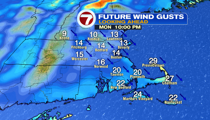
The breeze will become northwesterly by Monday night… the precursor to a major change in the temps this coming week. With cooler, direr air moving back into New England, temperatures plummet!!! By Tuesday, we’ll only have highs in the low to mid 40s. It’ll be a brighter day, but a cool one, even by November standards.
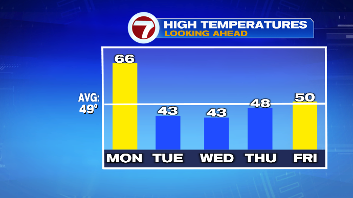
Well stay mostly sunny and cool on Wednesday, but by Thanksgiving day we’ll be tracking our next storm. Right now it looks somewhat similar to our Sunday night storm, in that it will push up the coast and bring us rain and wind in time for the holiday.
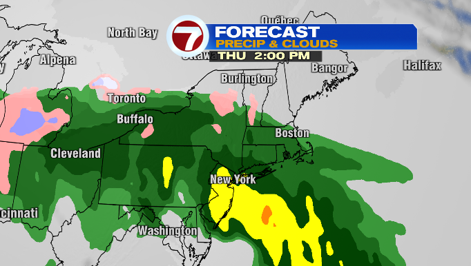
If it times up juuuust right with cooler air, we could even see a bit of winter weather in the higher elevations. While rain looks most likely right now, this will be the big thing to track this week, especially with Thanksgiving right around the corner!


